![](/images/other/stat-length.png)
![Randonnée V.T.T. Les Damps - Entre Seine et Eure - Les Damps - Photo](https://media.geolcdn.com/t/1900/400/ext.pjpeg?maxdim=2&url=https%3A%2F%2Fservices.sitytrail.com%2FGeolivesWS%2FDownloadMedia.ashx%3FTrailID%3D173142%26Media%3D14703_6.jpg)
Entre Seine et Eure - Les Damps
tracegps
Utilisateur
![Longueur](/images/other/stat-length.png)
Longueur
33 km
![Altitude max](https://static1.geolcdn.com/siteimages/upload/files/1508320355ic_sort_altitude_max_24dp.png)
Altitude max
53 m
![Dénivelé positif](https://static1.geolcdn.com/siteimages/upload/files/1508320355ic_sort_den_pos_24dp.png)
Dénivelé positif
211 m
![Km-Effort](/images/other/stat-length.png)
Km-Effort
36 km
![Altitude min](https://static1.geolcdn.com/siteimages/upload/files/1508320355ic_sort_altitude_min_24dp.png)
Altitude min
1 m
![Dénivelé négatif](https://static1.geolcdn.com/siteimages/upload/files/1508320355ic_sort_den_neg_24dp.png)
Dénivelé négatif
211 m
![Boucle](https://static1.geolcdn.com/siteimages/upload/files/16400158638029165_repeat_loop_refresh_sync_direction_icon.png)
Boucle
Oui
Date de création :
2014-12-10 00:00:00.0
Dernière modification :
2014-12-10 00:00:00.0
![V.T.T.](https://static1.geolcdn.com/sitytour/trail-icons/202.png)
2h00
Difficulté : Moyen
![Scannez ce code QR pour ouvrir la randonnée dans l'application SityTrail](https://capi.geolives.com/qq0zvz2zws4bq2lad0pu/sitytour/trails/173142/qr.png?size=200)
Application GPS de randonnée GRATUITE
À propos
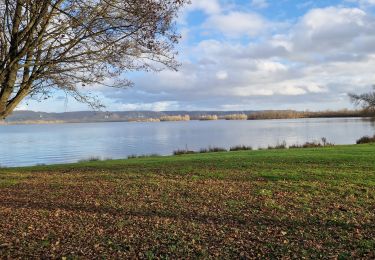
Randonnée V.T.T. de 33 km à découvrir à Normandie, Eure, Les Damps. Cette randonnée est proposée par tracegps.
Description
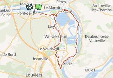
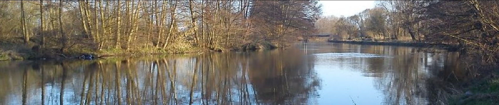
Petite balade entre Seine et Eure avec passage par le Lac des 2 Amants, Poses, Saint Pierre du Vauvray, Le Vaudreuil. Pas de grande difficulté.
Localisation
Pays :
France
Région :
Normandie
Département/Province :
Eure
Commune :
Les Damps
Localité :
Unknown
Départ:(Dec)
Départ:(UTM)
366615 ; 5462912 (31U) N.
Commentaires
Randonnées à proximité
![Randonnée Marche Sotteville-sous-le-Val - Sotteville sous le Val vers Igoville - Photo](https://media.geolcdn.com/t/375/260/ext.jpg?maxdim=2&url=https%3A%2F%2Fservices.sitytrail.com%2FGeolivesWS%2FDownloadMedia.ashx%3FTrailID%3D954232%26Media%3Dfix__20180427145133.jpg)
![Marche Marche](https://static1.geolcdn.com/sitytour/trail-icons/101.png)
Sotteville sous le Val vers Igoville
Marche
Facile
(1)
Sotteville-sous-le-Val,
Normandie,
Seine-Maritime,
France
![](/images/other/stat-length.png)
8,7 km | 9,3 km-effort
1h 48min
![](https://static1.geolcdn.com/siteimages/upload/files/16400158638029165_repeat_loop_refresh_sync_direction_icon.png)
Oui
![Randonnée Trail Les Damps - Autour du parcours sportif 2019 - Photo](https://media.geolcdn.com/t/375/260/ext.jpg?maxdim=2&url=https%3A%2F%2Fstatic1.geolcdn.com%2Fsiteimages%2Fupload%2Ffiles%2F1524743154running.jpg)
![Trail Trail](https://static1.geolcdn.com/sitytour/trail-icons/104.png)
Autour du parcours sportif 2019
Trail
Très facile
(1)
Les Damps,
Normandie,
Eure,
France
![](/images/other/stat-length.png)
10,9 km | 12,5 km-effort
Inconnu
![](https://static1.geolcdn.com/siteimages/upload/files/16400158638029165_repeat_loop_refresh_sync_direction_icon.png)
Oui
![Randonnée Marche Pont-de-l'Arche - Pont de l'Arche/ Les Damps (126) - Photo](https://media.geolcdn.com/t/375/260/ext.jpg?maxdim=2&url=https%3A%2F%2Fstatic1.geolcdn.com%2Fsiteimages%2Fupload%2Ffiles%2F1553511878bg_sport_marche.png)
![Marche Marche](https://static1.geolcdn.com/sitytour/trail-icons/101.png)
Pont de l'Arche/ Les Damps (126)
Marche
Moyen
(4)
Pont-de-l'Arche,
Normandie,
Eure,
France
![](/images/other/stat-length.png)
11,5 km | 13,9 km-effort
3h 3min
![](https://static1.geolcdn.com/siteimages/upload/files/16400158638029165_repeat_loop_refresh_sync_direction_icon.png)
Oui
![Randonnée Marche Les Authieux-sur-le-Port-Saint-Ouen - 076-81-les Authieux Igoville 15km-700-813 - Photo](https://media.geolcdn.com/t/375/260/ext.jpg?maxdim=2&url=https%3A%2F%2Fmedia.geolcdn.com%2Ff%2Facace470-e678-4207-9fe1-f083d26db0f1.jpg)
![Marche Marche](https://static1.geolcdn.com/sitytour/trail-icons/101.png)
076-81-les Authieux Igoville 15km-700-813
Marche
Très facile
(1)
Les Authieux-sur-le-Port-Saint-Ouen,
Normandie,
Seine-Maritime,
France
![](/images/other/stat-length.png)
13,9 km | 16,5 km-effort
3h 37min
![](https://static1.geolcdn.com/siteimages/upload/files/16400158638029165_repeat_loop_refresh_sync_direction_icon.png)
Oui
![Randonnée Marche Les Authieux-sur-le-Port-Saint-Ouen - 20240305-Gouy - Photo](https://media.geolcdn.com/t/375/260/ext.jpg?maxdim=2&url=https%3A%2F%2Fmedia.geolcdn.com%2Ff%2F182cda91-7c68-4fdc-9c70-5a8312292dd3.JPG)
![Marche Marche](https://static1.geolcdn.com/sitytour/trail-icons/101.png)
20240305-Gouy
Marche
Moyen
Les Authieux-sur-le-Port-Saint-Ouen,
Normandie,
Seine-Maritime,
France
![](/images/other/stat-length.png)
10,7 km | 13,1 km-effort
2h 35min
![](https://static1.geolcdn.com/siteimages/upload/files/16400158638029165_repeat_loop_refresh_sync_direction_icon.png)
Oui
![Randonnée Marche Criquebeuf-sur-Seine - 20240220-Criquebeuf Cool - Photo](https://media.geolcdn.com/t/375/260/ext.jpg?maxdim=2&url=https%3A%2F%2Fmedia.geolcdn.com%2Ff%2Feb5883de-1bb9-4eab-a328-2bbf2c282514.JPG)
![Marche Marche](https://static1.geolcdn.com/sitytour/trail-icons/101.png)
20240220-Criquebeuf Cool
Marche
Facile
Criquebeuf-sur-Seine,
Normandie,
Eure,
France
![](/images/other/stat-length.png)
9,8 km | 11 km-effort
2h 20min
![](https://static1.geolcdn.com/siteimages/upload/files/16400158638029165_repeat_loop_refresh_sync_direction_icon.png)
Oui
![Randonnée Marche Sotteville-sous-le-Val - 20240206-Sotteville sous le Val - Photo](https://media.geolcdn.com/t/375/260/ext.jpg?maxdim=2&url=https%3A%2F%2Fmedia.geolcdn.com%2Ff%2F10e7cce0-0471-4b6b-b343-86046b8aac60.jpg)
![Marche Marche](https://static1.geolcdn.com/sitytour/trail-icons/101.png)
20240206-Sotteville sous le Val
Marche
Moyen
Sotteville-sous-le-Val,
Normandie,
Seine-Maritime,
France
![](/images/other/stat-length.png)
11,4 km | 13,5 km-effort
2h 34min
![](https://static1.geolcdn.com/siteimages/upload/files/16400158638029165_repeat_loop_refresh_sync_direction_icon.png)
Oui
![Randonnée Marche Les Damps - 20231212-Les Damps - Photo](https://media.geolcdn.com/t/375/260/ext.jpg?maxdim=2&url=https%3A%2F%2Fmedia.geolcdn.com%2Ff%2F9b98702f-b952-4d47-95e5-e5dc435553fd.jpg)
![Marche Marche](https://static1.geolcdn.com/sitytour/trail-icons/101.png)
20231212-Les Damps
Marche
Moyen
Les Damps,
Normandie,
Eure,
France
![](/images/other/stat-length.png)
9,5 km | 11,1 km-effort
2h 39min
![](https://static1.geolcdn.com/siteimages/upload/files/16400158638029165_repeat_loop_refresh_sync_direction_icon.png)
Oui
![Randonnée Marche Les Authieux-sur-le-Port-Saint-Ouen - 20231107-Les Authieux Cool - Photo](https://media.geolcdn.com/t/375/260/ext.jpg?maxdim=2&url=https%3A%2F%2Fmedia.geolcdn.com%2Ff%2Fb16073a9-b9c2-470f-ab3b-b7d372608e04.JPG)
![Marche Marche](https://static1.geolcdn.com/sitytour/trail-icons/101.png)
20231107-Les Authieux Cool
Marche
Facile
Les Authieux-sur-le-Port-Saint-Ouen,
Normandie,
Seine-Maritime,
France
![](/images/other/stat-length.png)
8,6 km | 9,2 km-effort
2h 25min
![](https://static1.geolcdn.com/siteimages/upload/files/16400158638029165_repeat_loop_refresh_sync_direction_icon.png)
Oui